If this were an ACME cartoon, that alarm clock wouldn’t have stood a chance. 5am. The kind of hour that makes you question every life decision that led to this moment — particularly the one where you decided that voluntarily driving to the Lake District before most people are awake counted as a good use of a day off. A quick shower, coffee in a travel mug, breakfast grabbed for the road, and I was away. The car was already packed the night before, which was the one act of forward planning that my half-conscious self was genuinely grateful for.
The drive north takes a little over two hours to reach Kentmere, and at least at the end of May the early start doesn’t mean driving in the dark — there’s something to be said for long evenings and even longer mornings. By the time I arrived the hamlet was sitting under a mild, grey, overcast sky. Not unpleasant. Just that flat Lake District light that sits on the fells like a blanket and, usefully, keeps the crowds away. Kentmere on a busy weekend can feel hemmed in; on a quiet day with low cloud it feels like it belongs to the sheep and the stonework, which is exactly how I prefer it.
The Route
Today’s route was the traditional Kentmere Horseshoe — but with a twist. Anyone walking with me would have noticed me disappearing from the path at regular intervals, off into moorland or cloud or both, before reappearing looking like nothing unusual had happened. This is the ML version of the walk: the parts everyone else walks straight through become the parts where I’m practising navigation in earnest.
From the little church at Kentmere, the path climbs through rocky ground via Crabtree Brow and up to Garburn Pass. On the way up I met a gentleman coming the other way — heading downhill, walking coast to coast, hoping to stay over in Kentmere before the next leg. We stopped to chat for a few minutes: the route he was on, the route I was doing, walking in general, and leadership qualifications. The kind of chance encounter that tends to happen more on the fells than anywhere else — two people going in opposite directions, briefly occupying the same stretch of path, comparing notes before continuing their respective days.
After the gate on the Garburn path I cut across open moorland, bypassing the corner at Garburn Nook and picking up the path further on. Good practice: on a clear day it’s an easy confidence-builder; in poor visibility the same shortcut demands proper attention. I stopped for a few minutes after rejoining the path — jacket off, pack adjusted, time to do the five D’s properly and settle into the navigation rhythm.
Between the path near Garburn Nook and the climb up to Yoke, the skylarks were in full voice. Deafening, if that’s not too strong a word for a bird that weighs less than a bag of crisps — but there’s something about the cumulative effect of several of them going at once that fills a fellside completely. I spotted one occasionally, that characteristic hovering speck high against the grey sky, but mostly they were sound rather than sight: a continuous, looping call that follows you up the path long after you’ve stopped looking for the source of it.
The path climbs gradually from here, and I’ve learned to use that gradient to my advantage: each contour feature becomes a checkpoint. Is that stream crossing the path where the map says it should? Is there actually a reentrant here or am I inventing features out of wishful thinking? Slow, deliberate, methodical. The odd fell runner passing in the opposite direction looked like they were having considerably more fun than me, but they also weren’t carrying a full day pack, so I held my tongue.
Yoke, and the Spring Hunt
Reaching the cairn at the top of Yoke felt like a milestone, which is appropriate given that it marks the start of the ridge proper. But first: the spring. There’s something about being handed a navigation objective that exists off the obvious line that focusses the mind considerably. I disappeared off the summit area into passing cloud and drizzle — the kind of light mist that makes the moorland look a little otherworldly — and descended over rough terrain to locate the spring at the head of the stream.
It was not, I should note, giving Fountain of Youth vibes. It was more along the lines of ‘I haven’t seen anything that looks definitively like moving water in a while, but this might qualify’. Job done, I hand-railed the fence back up to the path — a useful technique in low visibility: the fence is the handrail, the terrain is the noise. A couple on the main path gave me a look that suggested appearing from the middle of nowhere was not a standard element of their Kentmere Horseshoe experience. I didn’t stop to explain.
Ill Bell and Froswick
The ridge walk along the cairns at Ill Bell is one of those sections where the terrain does a reasonable impression of being straightforward until it isn’t. I picked my way through carefully: balance, foot placement, not committing weight until the ground confirmed it would take it. There was a moment near one of the edge sections where I stopped for a photo — excellent view, slight heart rate elevation, would not describe myself as entirely casual about it, but the shutter got pressed and the ground held firm. A small personal victory, filed under ongoing work.
From Ill Bell I could already see the shape of the afternoon ahead — the ridge continuing over Froswick before the rise to Thornthwaite Crag. A quick time check suggested it was worth thinking about lunch sooner rather than later.
Thornthwaite Crag and Lunch
The detour to the beacon at the top of Thornthwaite Crag added a little to the day but felt worth it. There’s something satisfying about a summit that has a clear, visible landmark at its highest point — navigation confirmed, position unambiguous. I settled behind a wall out of an increasingly insistent wind for lunch, and took stock.
INFO: Thornthwaite Beacon
The summit of Thornthwaite Crag is dominated by Thornthwaite Beacon, a 14-foot columnar cairn that looms over the wall junction at the top and can be seen for miles across the Far Eastern Fells. Nineteen beacons were recorded across Westmorland and Cumberland in the 15th century, forming a coordinated signal network used to relay warnings of Scottish raids and invasion. Thornthwaite’s commanding position above four valleys would have made it an obvious node in that chain. The stone pillar standing today marks that history, though it also sits precisely at a boundary wall corner, suggesting it served a dual purpose as a grazing land marker too.
Sheltered by the wall with a sandwich and a flask, I revised the afternoon plan. Rather than heading all the way to High Street and back down the full horseshoe, I’d take a more direct line across to the Mardale Ill Bell cairn. Slightly shorter, but requiring a bearing from the wall and some navigation over open ground. This felt like exactly the kind of decision you’d make with a group: conditions, time, energy levels, objectives balanced against each other.
The Cairn I Nearly Missed
I’ll be straightforward about this one: I missed the Mardale Ill Bell cairn.
Not by much, and not without immediately recognising it. On the bearing from the wall I followed the top of the horseshoe around Bleathwaite Crag, and somewhere in the final approach I let my attention drift — distracted by the view out over the valley and the outcrops below, which are genuinely worth looking at, but are not the objective. What I saw ahead of me wasn’t the terrain I was looking for. The ground flattened out to another rocky outcrop overlooking Nan Bield Pass. I’d overshot the cairn by perhaps a hundred metres.
I turned back, found it, ticked it off. But the DLOG entry writes itself: I was disappointed in myself. In practice, on a clear day with a group, I’d likely have been on the main footpath all the way to the cairn without needing any independent navigation — so the stakes were low. But in poor visibility, or with a group relying on my positioning, that same lapse would have mattered considerably. The important thing, as I noted it down, is that I knew immediately where I was when I arrived at the wrong place. Recognising the error and correcting promptly is the skill. Not making the error in the first place is the aspiration.
Down to the Reservoir
After regrouping at the shelter below Harter Fell, I made a call to drop off the ridge early and take the valley route back via Kentmere Reservoir. The wind had been building all afternoon and the ridge was offering diminishing returns. This turned out to be an excellent decision, not because the lower route was easier (the boulder field and rocky descent demand their own kind of attention) but because I had the entire valley entirely to myself — or near enough. Just me, Drygrove Gill, and a notable number of sheep.
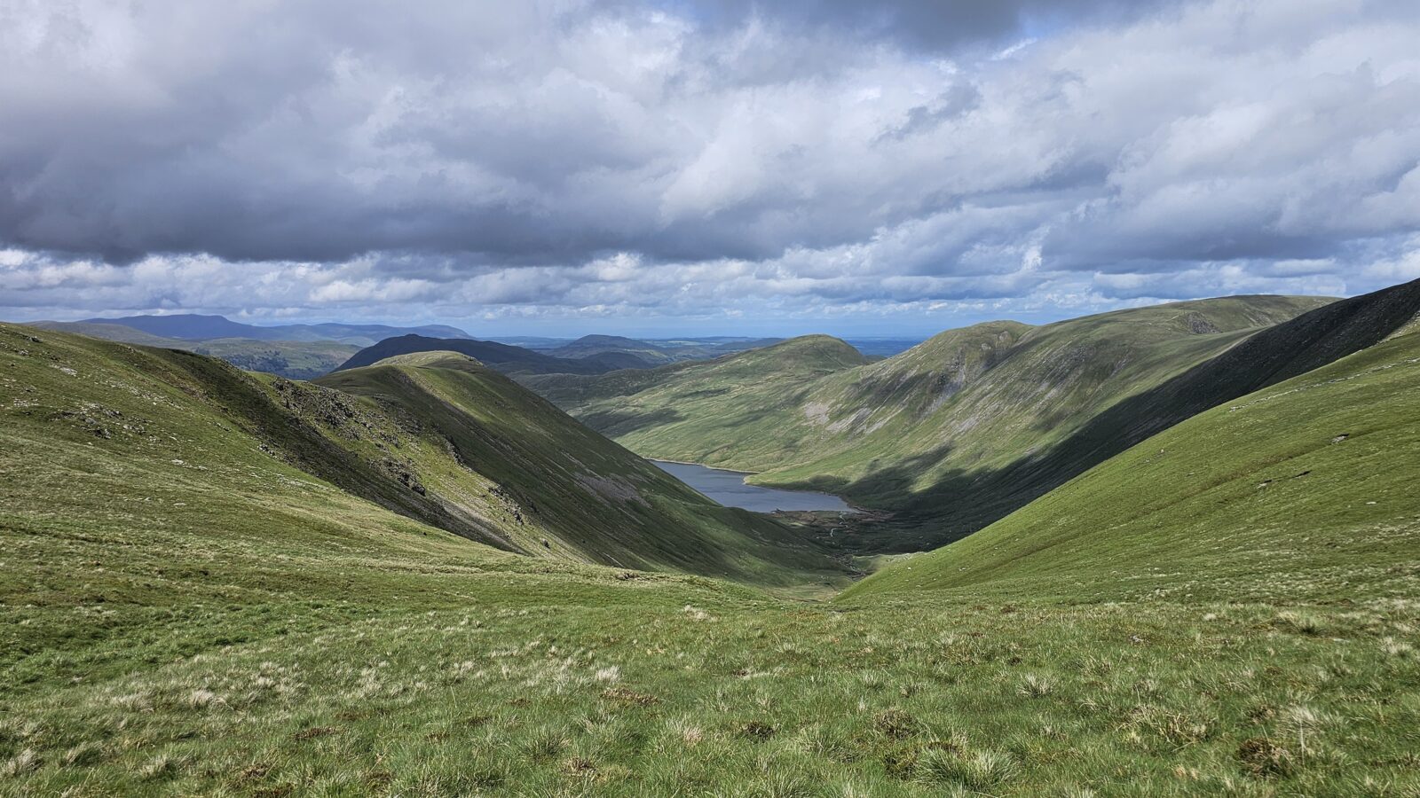
At Smallthwaite Knott I had a fine view over the reservoir before the descent proper. And somewhere on the approach, two wild hill ponies appeared — completely unbothered by the interruption, happy to be photographed, and surprisingly disinclined to move on. In my experience, animals that look like they might bolt usually do. These two had clearly not received that memo and seemed perfectly content to stand there while I got the camera out. Good ponies.
At the reservoir end I went to look for the ancient settlement I’d been vaguely aware of in the area — didn’t have time to explore fully, but enough to note the location and mark it firmly as a reason to return.
INFO: Ancient Settlement at Tongue House
Just below Tongue Scar, near the River Kent, lie the earthwork remains of an ancient settlement at Tongue House — one of at least five prehistoric compound sites in the Kentmere valley, featuring the remains of round houses and stockyards. Archaeological evidence suggests the site was occupied across multiple periods, from the Bronze Age through to Romano-British times, a reminder that this quiet valley has been home to people for thousands of years.
A short distance further on I stopped on a stile with a brew and a flapjack — a combination that deserves to be enshrined in some kind of fell-walking charter — and watched a local farmer and his family out on the hillside planting trees. Practical conservation work: managing soil erosion and water runoff in a valley that sees plenty of both. There’s something quietly reassuring about watching people working on the long game.
The Long Walk Back
The final 8km from the shelter between Lingmell End and Harter Fell back to the car was entirely uneventful. I didn’t see another person. The path wound down quietly, the light stayed flat and grey, and the fells gradually softened back into the valley. Sometimes the best part of a long day in the hills is this — the part where you’ve done what you came to do, the objectives are ticked off (mostly), and you can simply walk.
Boots off at the car. Camping stove out — remembered to pack it this time, which felt like a minor organisational triumph — and a proper brew made the right way. The cake had been sitting in the cool box since I’d picked it up on the way through that morning, and it was considerably better for the wait. Then the two-hour drive home, replaying the day and thinking about what goes in the DLOG.
Kentmere Horseshoe: ticked. The cairn at Mardale Ill Bell: found, eventually. The ponies: photographed, cooperative, entirely unbothered. The spring above Yoke: located, unimpressive, entirely the point. QMD Day 2: done.